
Black Elk Peak offers beautiful Views of the Black Hills & Custer State Park
(Check out this guest post from my son, Caleb, sharing about his most recent adventure to Black Elk Peak

A little history
If you ever find yourself anywhere near the Black Hills of South Dakota and you like to hike, then a half a day spent climbing to the summit of Black Elk peak is a must for your itinerary. I have had the privilege of hiking in many states across the country and hiking to the top of Black Elk Peak ranks as one of my favorite hikes that I have ever done.
I was first introduced to the hike in the summer of 2015 while on a family vacation in the Black Hills. At that point in time the mountain was still known by its former moniker, Harney Peak (or, as my younger brother put it with his freudian slip, “Hiney Peak”). I enjoyed the hike so much that when I revisited the area in the summer of 2024 with my wife, kids, and extended family, I made it a point to trek to the top
again and introduce my wife to the adventure. It’s one of those hikes I could do again and again.
Area Details
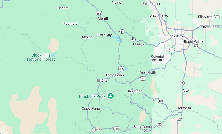
As I mentioned previously, Black Elk peak is located in the Black Hills of South Dakota. With the summit measuring in at 7,244 feet the mountain is the tallest peak in South Dakota and also the tallest peak in the United States East of the Rocky Mountains. It is located in Pennington County and is not far from the popular Mount Rushmore. In fact, although you cannot see the “Four Heads” as we call them in my family, you can see the mountain on which they lie and the parking deck below it from the top of Black Elk Peak.
A large majority of the hike lies within Custer State Park with the summit itself and some of the surrounding area falling within the Black Elk Wilderness and Black Hills National Forest. Other nearby attractions include Mount
Rushmore, Custer State Park, Pactola Reservoir, Jewel Cave National Monument, and Wind Cave National Park. Rapid City is the closest major city and the location of the closest major airport.
What’s in a name?
Up until 2016, the mountain was known as Harney Peak in honor of US General William S. Harney. Thus, at the time of my first visit, the name was close enough in sound to allow my brother to misspeak and cement in my family’s memory that we had successfully climbed “Hiney Peak”. However, in 2016 the name of the mountain was changed to Black Elk Peak in honor of the Lakota Sioux medicine man. As of my last visit, the plaque on the fire tower on top of the summit still bore the name “Harney”.
What you will see
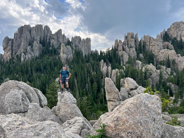
Rugged beauty is the term that comes to mind when I think about how to describe the mountain and its surrounding area. Prepare yourself for boulders and precipices, rocky spires, far-reaching vistas, and even tree cover with refreshing shade at various points along the trail. As you go, you will have a variety of terrain and vegetation. If you plan your journey at the right time of year you will be excited to find beautiful wild flowers and maybe even some wild raspberry bushes along the way.
Important details
The best way to hike Black Elk Peak is by starting at the Sylvan Lake Day Use Area in Custer State Park. Sylvan Lake is a highlight destination in itself, so be sure to check it out either before or after your hike. Be mindful that depending on the time of year and time of the week that you choose to hike Black Elk Peak, the Sylvan Lake Day Use Area can be extremely busy.
The last time that we visited was on a Friday afternoon in August and there was almost no where to park. Another thing to keep in mind is that since the lake is in Custer State Park, you do have to pay a fee for day entry into the park. Approaching the Sylvan Lake Day Use Area there will be a gate for Custer State Park where you can pay your fee. I would encourage you to avoid weekends during the summer if possible or try to show up early to beat the crowds and secure parking.


Trail Options
Once you find parking at Sylvan Lake, you will want to locate the trailhead area. There is a small pavilion located next to a bathroom. Here you will find a posted map of the Black Elk Peak Hike and other information about Custer State Park. The summit may be reached via several combinations of trails and as either a loop hike (7.1 miles) or as an out and back.
My preference is to begin at the Sylvan Lake Day Use Area using Trail #4 (see Custer State Park Trail Map) and proceed past Little Devil’s Tower. You will
come to a junction where you can take a 0.4 mile side trail up to the prominence of Little Devil’s Tower. If you choose to add this to your hike, you will then have to hike the 0.4 miles back and continue on Trail #4. At the junction with Trail #3, take a left and follow this trail until you meet Trail #9. Turn right and follow Trail #9 all the way to the summit. To complete the loop, you may follow Trail #9 all the way back to Sylvan Lake.
If you prefer an out and back, simply retrace your steps via Trails #3 and #4. I prefer the loop so that you are getting new scenery throughout the entire hike. In my opinion, Trails #3 and #4 offer better scenery with less tree cover. Trail #9 is more
within a canyon and offers slightly less views (though still beautiful). Save this part of the trip for the back half of your hike when you are tired and less engaged with the view around you. If you do choose to do an out and back, Trails #3 and #4 offer much more of a payoff than Trail #9.


Things to remember
I consider the hike to be moderate in difficulty. There is nothing at all technical about it and the trails are well maintained. The difficulty lies simply in the length and the elevation change (nearly 1,500 feet of gain for the loop hike). If you are in good cardiovascular shape and enjoy a long hike, you will be good to go. Plan on at least 3-4 hours for the whole trek (unless you are like me and like to stop at every single viewpoint possible…then you may have to plan the whole day).
You may also want to budget some extra time to explore the summit and enjoy the views. Finally, make sure you pack plenty of water. The hike is long and strenuous and, depending on the time of year, the weather can be very warm and dry. It can’t be over stated how important it is not to run out of water.

You’ve reached the top
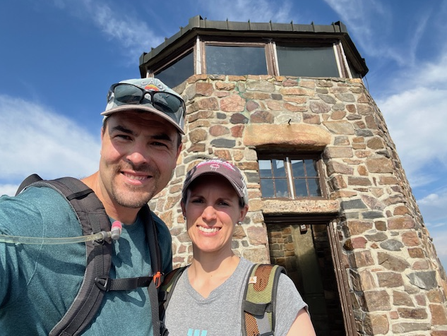
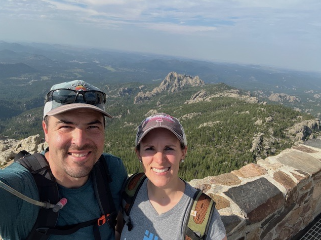
Once you reach the top, there is an old fire tower, dam, and pump house built by the Civilian Conservation Corps in the 1930s. From the fire tower, you can see a 360 degree view of the surrounding area including glimpses of four states on a clear day (Montana, Wyoming, Nebraska, and South Dakota). Take a look to the East and see if you can spot the side of Mount Rushmore with its parking deck just South of it.
While you are on the top, keep an ear out for the train whistle of the 1880 train (another excellent, nearby excursion that allows you to ride a vintage steam train from Keystone to Hill City). Below the fire tower the summit opens up onto a wide rocky plateau that can be fun to explore. Just make sure to watch your step and keep an
eye on the fire tower. There are no trails across the summit so make sure you can find your way back to the fire tower to begin the climb back down.

If you find yourself in the Black Hills, you won’t regret devoting some of your time to Black Elk Peak. Remember to plan ahead for your day use fee to get into Custer State Park and to arrive early to Sylvan Lake to secure parking. A good navigation app such as All Trails or onX is also advisable to help make sure you don’t lose your way. Once you hit the trail, enjoy the views and take in all the rugged beauty around you. I assure you it will be time well spent.
A huge thank you to my son, Caleb Beyer, for writing this blog post from their hike this summer. I 100% agree with his opinion. This hike is just stunning. We took our whole family to the Black Hills this summer and had a super week. Stay tuned for more info about the whole area.
I hope you find this information helpful as you plan a trip to the Black Hills area of South Dakota. I would love it if you would like, comment or share this blog post or even better do all three. I hope you will find me and follow me on Facebook, Instagram, Pinterest, LinkedIn, TikTok, and X. Check out how I plan an adventure in this post.
Keep adventuring,
Stephanie
seymoreoftheworldwithme.com